Is a USBL positioning system best for shallow hydrographic surveys?

Mapping the seabed or tracking in shallow water requires a different approach to deep sea projects. Changes in the water environment, depth fluctuations and the closeness between seabed surfaces and the vessel are all challenges for shallow water hydrographic surveys.
As such, surveyors need to adapt their equipment and techniques to capture accurate data when working in a harbour, port or close to the coastline. Using the right USBL system correctly is one of the best ways to survey shallow water areas. This article will explain why and the methods you can use to get accurate results.
What depth is considered shallow water?
Usually, shallow water is defined as an area where the seabed is 300 metres deep (1,000 feet) or less. Areas close to the coastline, at a quayside or in a harbour structure are likely to be considered as shallow waters.
Shallow water hydrographic surveys are used for a variety of applications. These include establishing pre-construction risks for offshore wind farms, identifying navigational safety issues in ports or harbours and running environmental management checks on coastlines. The same subsea equipment can also be used for diver tracking purposes.
Using a USBL positioning system in shallow water
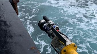
As the name suggests, using an Ultra-Short Baseline (USBL) system with a transponder beacon and transceiver is ideal for shallow water positioning surveys and diver tracking. Although some of these acoustic positioning systems can work in depths up to 4000m, they’re mostly used to locate objects and track divers in shallower waters.
If you are using a USBL system in areas where the water isn’t as deep, then you need to take a different approach to get accurate measurements.
Tilt your transceiver
For shallow water work, tilting your transceiver instead of putting it face down into the ocean is recommended. Tilting it at 30 degrees will create an optimal cone of operation behind the vessel, particularly if it’s towing various equipment such as side scans and multi beams.
However, if you do tilt the head, you need to adjust the settings accordingly. You also need to be aware of the resulting blind spot outside of the cone of operation (towards the front of the vessel, if it’s towing). As the transceiver doesn’t work on a negative depression angle, you won’t be able to see anything from that direction.
Tilting the head can also limit the flexibility of your operations, depending on what the ship is doing. However, if the vessel is towing the object it wants to track, then it won’t be an issue.
Set the speed of sound correctly
Speed of sound is the biggest challenge with shallow water measurements. This is the time it takes for an acoustic signal to travel through a target and back to a transceiver, which is used to work out its exact location.
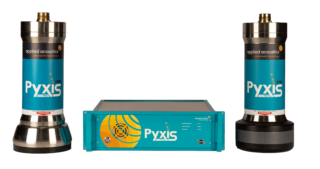
In a USBL, the receive elements in the heads are very close together. So if the speed of sound setting is inaccurate, then the calculated position will be, too. The accuracy will get worse as the target range increases. Having precise sound velocity probes or another item of equipment is essential to getting precise readings. Our Nexus and Pyxis systems can also mitigate this issue by inputting an accurate sound velocity profile.
This is particularly important in the water column, which is affected by pressure, salinity and temperature.
Be aware of multi-path
Multi-path is where signals bounce off surrounding hard surfaces as well as the seabed or water surface before coming back to the transceiver. This can cause misreadings and is a risk in areas like harbours or ports, where there are significant subsea structures.
You can eliminate this by turning down the transmit power or using a low-powered beacon and reducing your receiver sensitivity. These are all adjustable within the USBL software. This gives you a better signal-to-noise ratio for tracking in shallow water.
This adjustment will strengthen any signals from the direct path and weaken those from the multi-path (the further it travels, the quieter it will be). A less sensitive receiver will not pick them up, or will do so only faintly, allowing the transceiver to decipher the direct from the multi-path replies.
Keep environmental changes in mind
The temperature will obviously change with the depth of the water. If you’re working somewhere particularly hot, the sea will be fairly warm at the surface. As you go deeper, the temperature will decrease, level out and become more stable. Either way, you’ll need an accurate temperature measurement to accurately build the profile in the system.
Salinity can vary according to your proximity to the coast, especially if you are near any areas where a freshwater river is feeding into the sea. If freshwater affects the salinity, then your speed of sound will also be affected.
Accurately measuring the speed of sound is best done with a dedicated sound velocity probe. You can then upload the profile to the USBL system. There are temperature sensors inside the USBL console, and you can work out the speed of sound using tables, but there’s nothing better than a dedicated reading on the day.
The only other consideration is noise from thrusters and wash from other vessels. Rough seas or rain do not really have any impact. However, if the sea is very calm, you can get multi-path readings from a signal bouncing off the flat surface. All this needs to be taken into account when building a profile.
How to set up a hydrographic survey vessel in shallow water
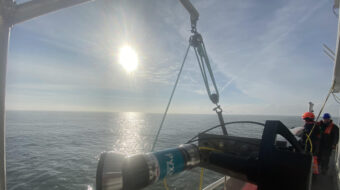
Transceivers can be mounted over the side of the vessel on a pole mount or through the vessel itself via a gate valve or a moon pool. They must always be positioned at least a metre below the lowest point of the vessel. Although the deeper it’s placed the better to avoid any excess vibration on the installation.
This also reduces any reflections hitting the vessel’s hull and coming back to the receiver head as a reply. If this happens, you’ll generate invalid readings and compromise your survey. So, keep the head away from the bottom of the vessel and any thrusters or direct propeller wash that could go over it to avoid false replies.
What subsea equipment is best for shallow hydrographic surveys?
Along with the right approach, having the right subsea equipment will help you get accurate readings for your shallow hydrographic survey. This includes the right transponder beacon for your needs and an intuitive USBL system.
Transponder beacons
There are various types of transponder beacons for different applications. Some go on divers or on ROVs, and some are mounted to a fixed frame that’s placed on the seabed. Both allow you to accurately position the frame or beacon.
The data output can then feed into a ship’s dynamic positioning system to monitor a fixed target or follow a moving one. It can also be interfaced into standard survey packages and combined with data from other equipment to create a geographical representation.
Omni-directional beacons
An omni-directional beacon will give you accurate readings up to depths of around 1,000 metres. This is preferable to a directional beacon, which only starts to become effective at depths upwards of 750 metres.
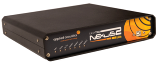
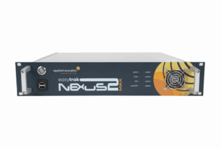
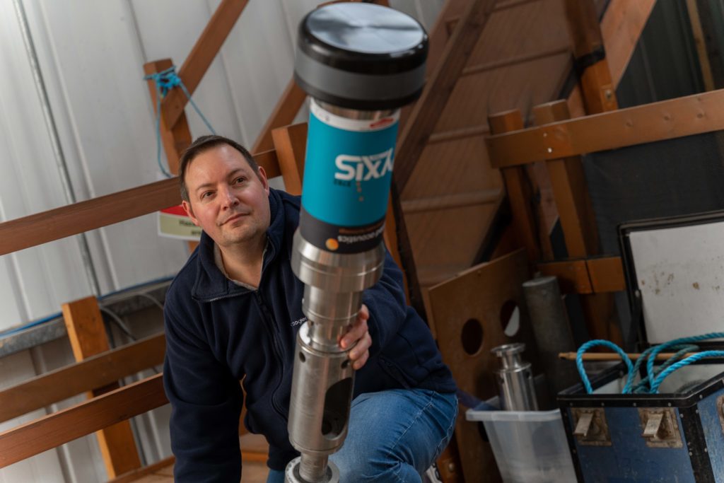
The Nexus 2, Nexus 2 Lite and Pyxis systems all have omni-directional heads. This means they can track almost on the horizontal, making them perfect for shallow water targets. Ranging in depth from up to 500 metres to 3,000 metres, they also come with directional heads, meaning they can be used for deeper waters or with the tilted method.
USBL systems
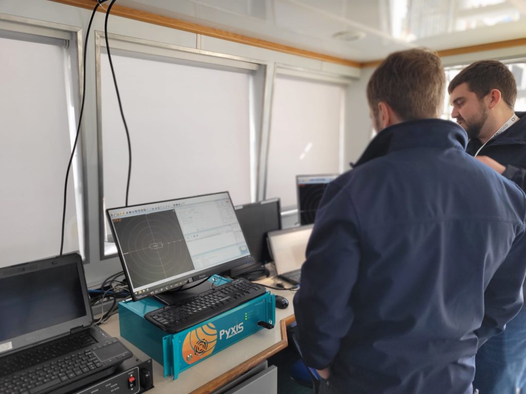
Having a USBL system and software that’s easy to adjust makes getting accurate readings straightforward. The controls on our USBLs are intuitively designed for this reason. This includes:
- The auto-gain function which adjusts based on the quality of the data received back from the beacon
- Settings operated with on-screen sliders
- A colour-coded histogram that will indicate the validity of the replies (green if it was good, red if not received and orange if received but not usable to compute a position)
This means you can adjust your settings and method to each individual scenario and the environmental conditions easily and in real-time. Powered by software, this can all be done without opening up the unit.
Get advice on your shallow water system
Talk to us today about your operations and the kind of results you want to achieve for yourself and your clients. Our experienced engineers and sales team can talk to you about your needs and help you find and use the right equipment to improve your shallow water data.